|
If you've never heard of Heard Island and McDonald Islands (HIMI), or would like some more information to build on what you alerady know, this is a good place to start.
A sub'Antarctic' island group situated in the middle of the Southern Ocean, the climate and weather at Heard Island and McDonald Islands (HIMI) isn't the most pleasant (for humans anyway - it doesn't seem to bother the many birds and seals that call it home).
Local Climate
The local climate on Heard Island is significantly influenced by the island’s perennial ice cover and mountainous nature, particularly the orographic effects of Big Ben on precipitation, snow accumulation, winds and cloud cover. The relatively low-lying McDonald Islands are free of permanent ice and, while windy, do not experience the highly changeable conditions of Heard Island.
Meteorological records at Heard Island are incomplete, but there is considerable evidence that the local climate is changing. Observations at Atlas Cove indicate an increase in average annual air temperature of almost 1°C between the periods 1948-1954 and 1997-2001. This mirrors similar changes interpreted from observations at nearby Îles Kerguelen and elsewhere in the southern Indian Ocean.
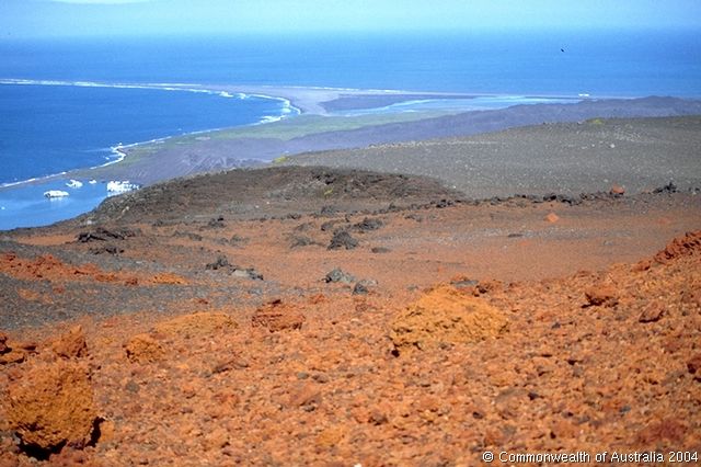
These increased temperatures are having a significant effect on the Heard Island environment, with glacial retreat leading to the formation of lagoons and freshwater lakes, and exposing new land for colonisation by plants and animals.
Weather - Cold, Wet, Windy and Cloudy
The maritime setting of the islands leads to low seasonal and daily temperature ranges, persistent and generally low cloud cover, frequent precipitation and strong winds.
Monthly average temperatures at Atlas Cove (at the north western end of Heard Island) range from 0.0° to 4.2°C, with an average daily range of 3.7 to 5.2°C in summer and -0.8 to 0.3°C in winter. Air temperatures at Spit Bay, only 25 km to the east can be remarkably different, with monthly mean temperatures being as much as 1.3°C higher.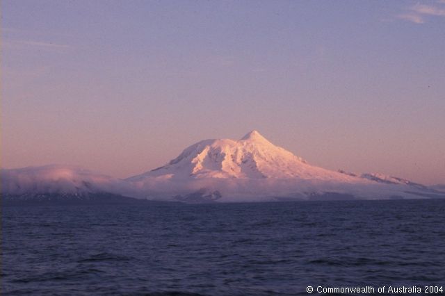
The winds at Heard Island are predominantly westerly and persistently strong. At Atlas Cove, monthly average wind speeds range between around 26 to 33.5 kilometres per hour. A maximum daily wind gust of greater than 180 kilometres per hour has been recorded on several occasions.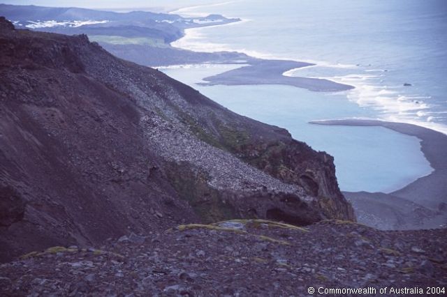
Annual precipitation at sea level on Heard Island is in the order of 1.3 to 1.9 m (water equivalent - some precipitation is in the form of snow), and records taken during the 1948-1954 ANARE expedition show precipitation occurring on 75% of days.
The high relative humidity at Heard Island (mean >80% year-round) together with the mountainous topography and strong winds, result in persistent cloud cover and often-spectacular cloud formulations, such as cap, lenticular and rotor (collectively ‘wave’ clouds) commonly observed over and downwind of Big Ben and to a lesser extent Laurens Peninsula.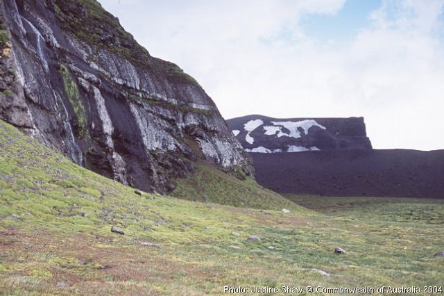
Atlas Cove, at the north-western end of the island, experiences significantly greater cloud cover (average 7.3 octas, where an octa equals one eighth of the celestial dome) than Spit Bay at the eastern end, in the lee of Big Ben.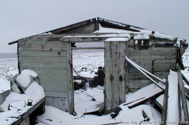
Considerable sealing activity had been going on since the 1770s at Îles Kerguelen, but Heard Island, only some 400 kilometres to the south-east, remained undiscovered until more southerly shipping routes into the Southern Ocean were adopted.
The first confirmed sighting of Heard Island was made on 25 November 1853 by Captain John Heard on the merchant vessel Oriental. Earlier sightings of land in the area in the 1830s are considered doubtful.
At the time of its discovery, Captain Heard’s wife was on board, and her description is the first recorded of the Island:
- “At 10 o’clock the Captain was walking on deck and saw what he supposed to be an immense iceberg. ... the atmosphere was hazy, and then a heavy snow squall came up which shut it out entirely from our view. Not long after the sun shone again, and I went up again and with the glass, tried to get an outline of it to sketch its form. The sun seemed so dazzling on the water, and the tops of the apparent icebergs covered with snow; the outline was very indistinct. We were all the time nearing the object and on looking again the Captain pronounced it to be land. The Island is not laid down on the chart, neither is it in the Epitome, so we are perhaps the discoverers, ... I think it must be a twin to Desolation Island, it is certainly a frigid looking place.”
The nearby McDonald Islands (approximately 40 kilometres further west) were discovered by Captain William McDonald on 4 January 1854. Poor weather at the time prevented a landing by the ship’s crew.
Due to the extreme isolation of Heard Island and McDonald Islands (HIMI), together with the persistently severe weather and sea conditions, human activities in the region have been, and remain, limited.
Since the first landing on Heard Island in 1855, there have been only approximately 240 shore-based visits to the island, and only two landings on McDonald Island (in 1971 and 1980).
The HIMI region is remote from any major population centres and conventional shipping routes but does receive visits from vessels involved in scientific research, fishing, fisheries surveillance and occasionally from tourist and other private vessels.
The ports from which these vessels have departed in recent years include Hobart, Fremantle, Albany, Esperance, Port Louis (Mauritius), Durban (South Africa), several ports in New Zealand and a variety of locations in Antarctica.
The seas in the HIMI region, which are normally rough, occasionally become sufficiently severe that vessels in the area seek a place of refuge in the lee of Heard Island. The Australian Antarctic Division (AAD) generally maintains one or two refuges on Heard Island which are equipped with basic provisions, but because their presence and ability to be maintained varies with AAD’s operational requirements these cannot be relied upon for shelter.
Due to its remoteness and lack of permanent population, there is no indigenous or recreational fishing activity in the HIMI region.
Australian commercial fishing within the HIMI exclusive economic zone (EEZ) began in April 1997, and targets mackerel icefish Champsocephalus gunnari and Patagonian toothfish Dissostichus eleginoides. Consistent with the HIMI Marine Reserve being assigned to the IUCN category strict nature reserve, commercial and recreational fishing in the Reserve is prohibited, however fishing vessels may cross the Reserve to reach fishing grounds.
The HIMI fishery falls within the area of application of the Convention on the Conservation of Antarctic Marine Living Resources (CCAMLR) and, more specifically, within CCAMLR Statistical Division 58.5.2.
The fishery is managed under the provisions of the Fisheries Management Act 1991 and the Heard Island and McDonald Islands Fishery Management Plan 2002 by the Australian Fisheries Management Authority (AFMA), in a manner that complies with or exceeds the standards required by the CAMLR Commission.
Conservation measures for fishing in the region include precautionary catch limits for both target and bycatch species, that take account of predator-prey relationships; independent scientific observers on all voyages; collection and analysis of a wide range of catch data and samples; restrictions to minimise non-target species interactions, and ongoing research on the ecological sustainability of targeted and bycatch fish stocks.
Holders of statutory fishing rights in the fishery contribute resources to, and assist in the conduct of, an annual fisheries research program to assess the status of fish stocks and other issues related to the presence of a commercial fishery, as stipulated in the management plan for the fishery. Some of this research is undertaken in areas within the Reserve under strict permit conditions. This research typically includes an annual survey designed to obtain reliable estimates of recruitment for each target species and other work to assist in monitoring of the potential impacts of the fishery on non-target species and the ecosystems of the HIMI region.
More information about the HIMI fishery is available from the AFMA website.
Illegal Fishing
Illegal foreign fishing is considered not to target waters of the HIMI Marine Reserve, but does occur in some locations outside the Reserve that coincide with the Australian commercial HIMI fishery. Illegal fishing therefore primarily threatens the fish targeted by the licensed fishery.
Australia is committed to combating illegal fishing in the EEZ around HIMI, and the region is the focus of growing national and international efforts to combat illegal fishing. A voluntary International Plan of Action for Illegal, Unreported and Unregulated (IUU) Fishing has been developed through the Food and Agriculture Organisation of the United Nations, within the framework of the Code of Conduct for Responsible Fisheries, and further measures may be adopted by the Commission for the Conservation of Antarctic Marine Living Resources.
Australia’s compliance and response actions are primarily the responsibility of the Australian Fisheries Management Authority (AFMA) and the Department of Agriculture Fisheries and Forestry, in close consultation with the Australian Antarctic Division (AAD), Attorney General’s Department, Department of Foreign Affairs and Trade, Department of Defence and Australian Customs Service.
|

